Do you have an explorer in your home? A child who loves to go new places and see new sites? Does your little geography buff spend hours with your globe intrigued with ideas of travel and exploration?
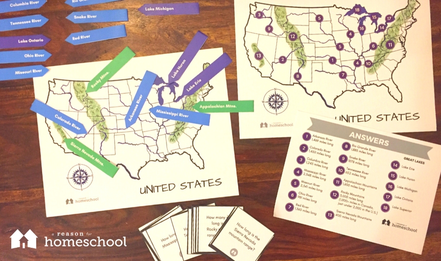
Today I have an educational download right up their alley – learning the major mountain ranges, names of the Great Lakes, and the main rivers of the continental United States of America. We have the three major mountain ranges, the five Great Lakes, and 10 main rivers to learn and label.
To set up t his activity for your child:
• Download and print our free geography activity PDF. I recommend printing color copies on card stock for durability.
• Fold the marker labels in half (this allows the name to be seen on both sides) and laminate them if you wish to.
• Optional: you could add a small Velcro strip just to the side of each river and mountain range along with a corresponding piece on each of the marker labels, so kids can work without their pieces sliding around.
Directions:
• Initially, give both the labeled and the unlabeled maps to your child.
• Go over the labeled map first, reading (or having them read) the names of each mountain range, lake, and river. Be sure to point out the capital letters and remind your child that because these are specific places, they are proper nouns and that’s why we have to capitalize them.
• Let your child use the labeled map right along side the unlabeled one a couple of times until they think maybe they can remember what goes where.
• Turn over the labeled map so they can’t see it, and let them figure out how many they can label on their own. When they’re finished, tell them to check their map against the pre-labeled version to see how they did and fix any that need correcting.
• Using the flash cards included in the download, quiz them on the length of each river or mountain range.
• You’ll notice there’s also a compass rose on our map. Using it for reference will allow you to quiz your child on directions. For example, “What is the closest river north of where we live?” or “Which mountain ranges on the map are west of the Mississippi River?” Make it fun by asking things like, “I am a river that runs north to south, who am I?”
Keep it short, light, and fun, and they’ll have these major geographic features memorized in no time!
Download your printable geography activity here:
Printable Activity: Geographical Features of the Continental U.S.
You may be asked to enter your email address if we don’t recognize you as a current subscriber.
Once you have, you can simply return to this page to download the file!

We encourage you to visit the A Reason For online store
to explore their excellent homeschooling resources.
